
PLATFORM OVERVIEW
Geo COSIM
Geospatial land information & quality workflows
← Back to all projects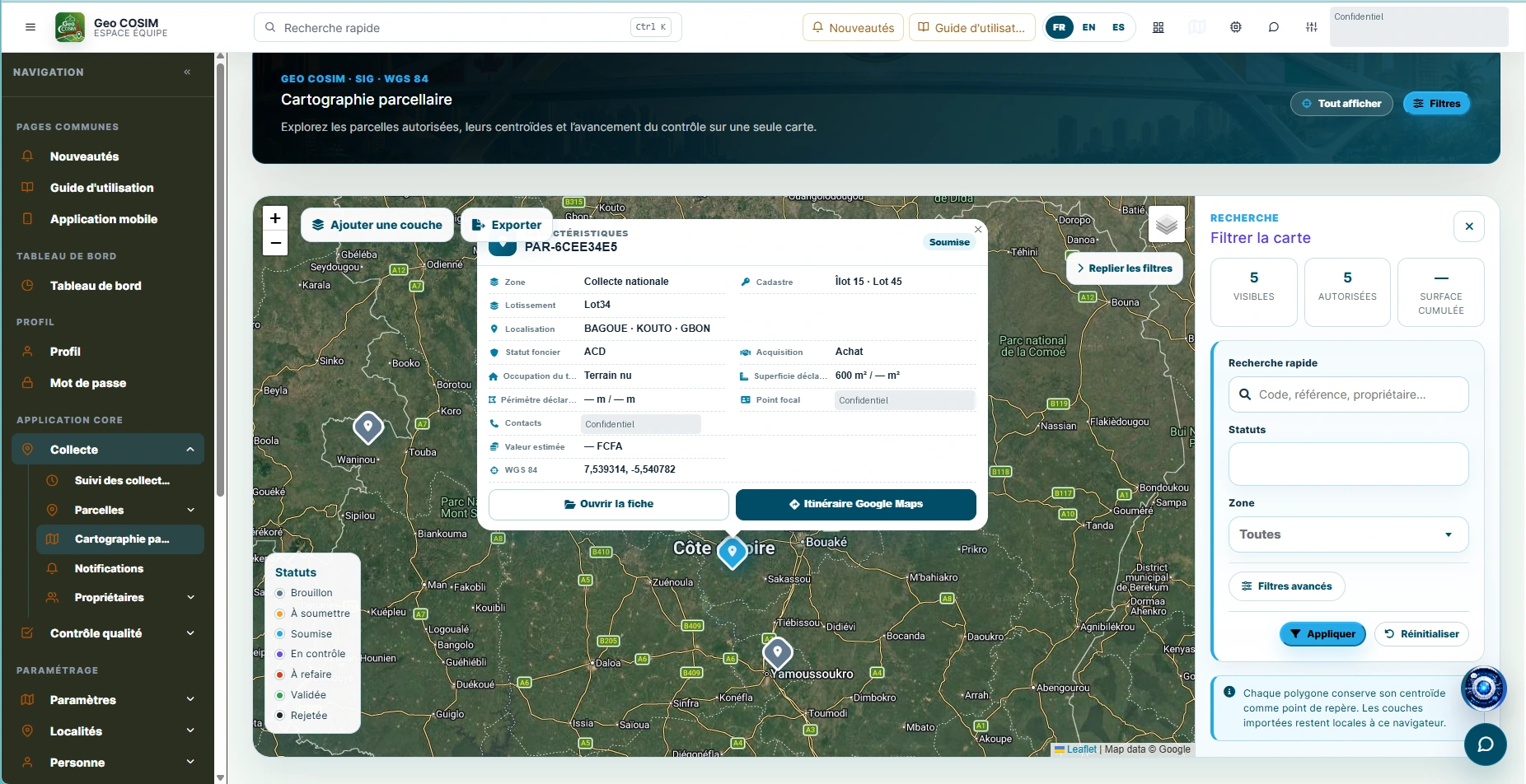
Parcel mapping & GIS layers 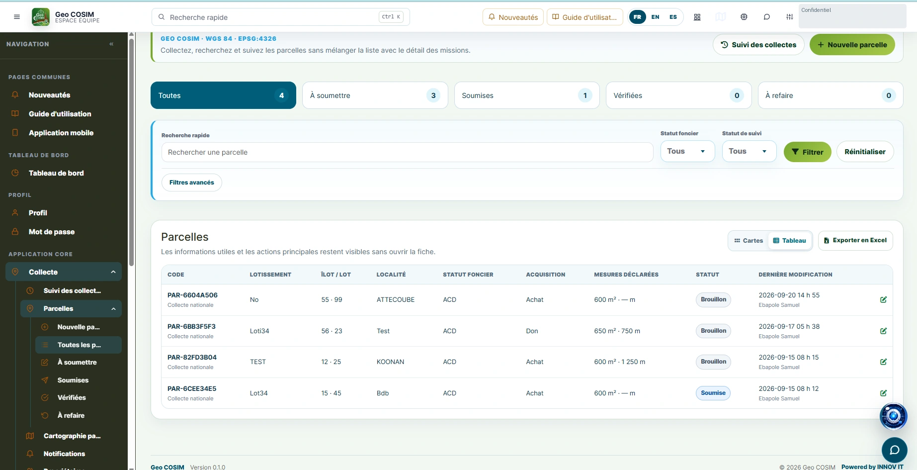
Parcel records 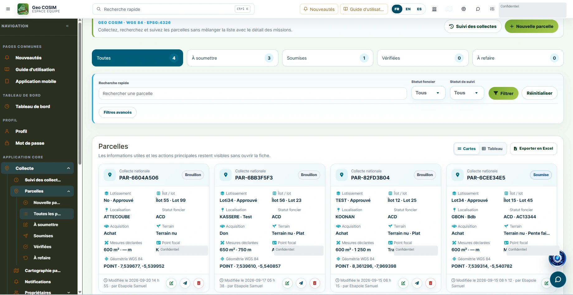
Collection monitoring 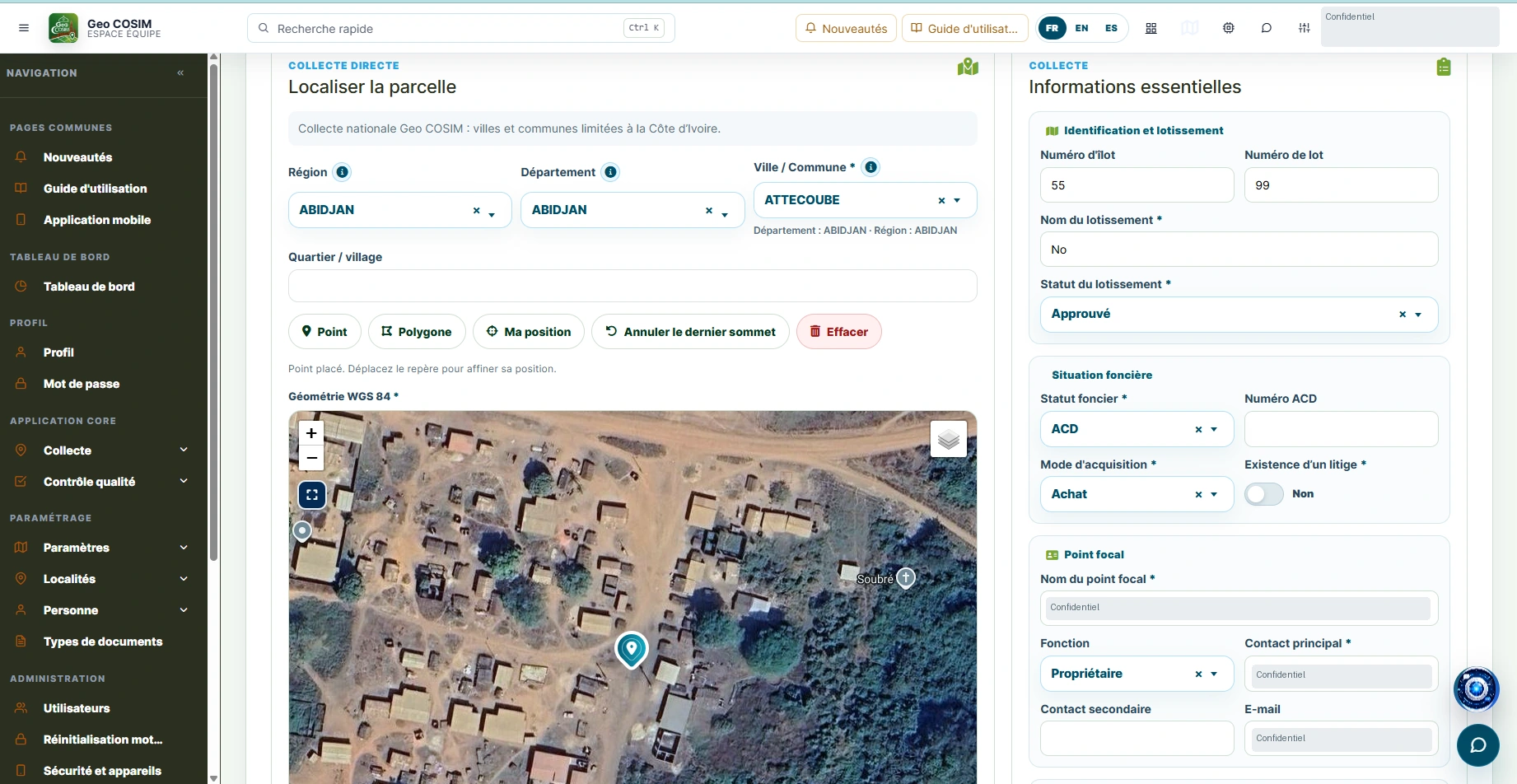
Georeferenced collection 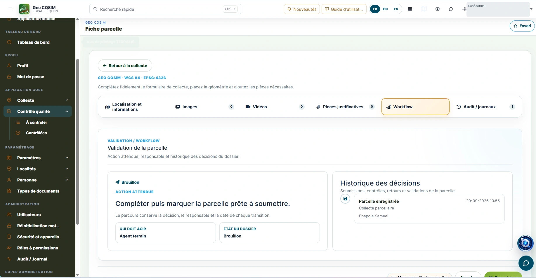
Validation & decision history 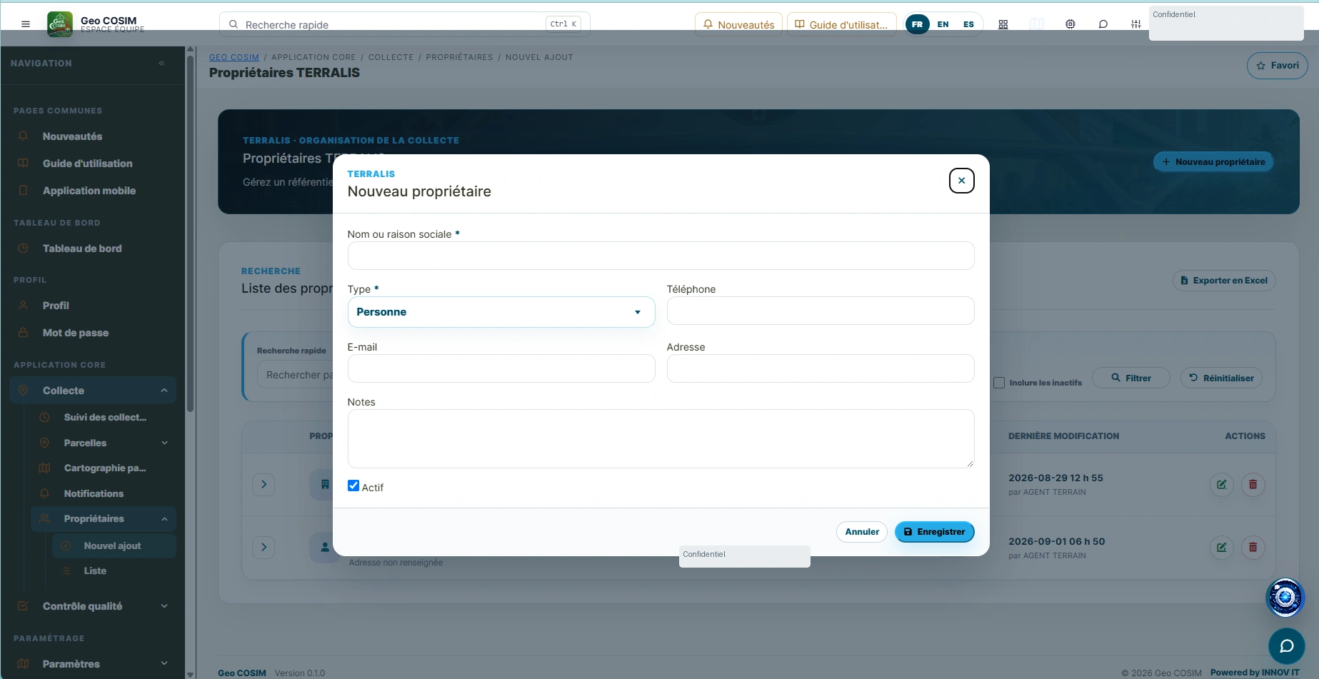
Owner information form 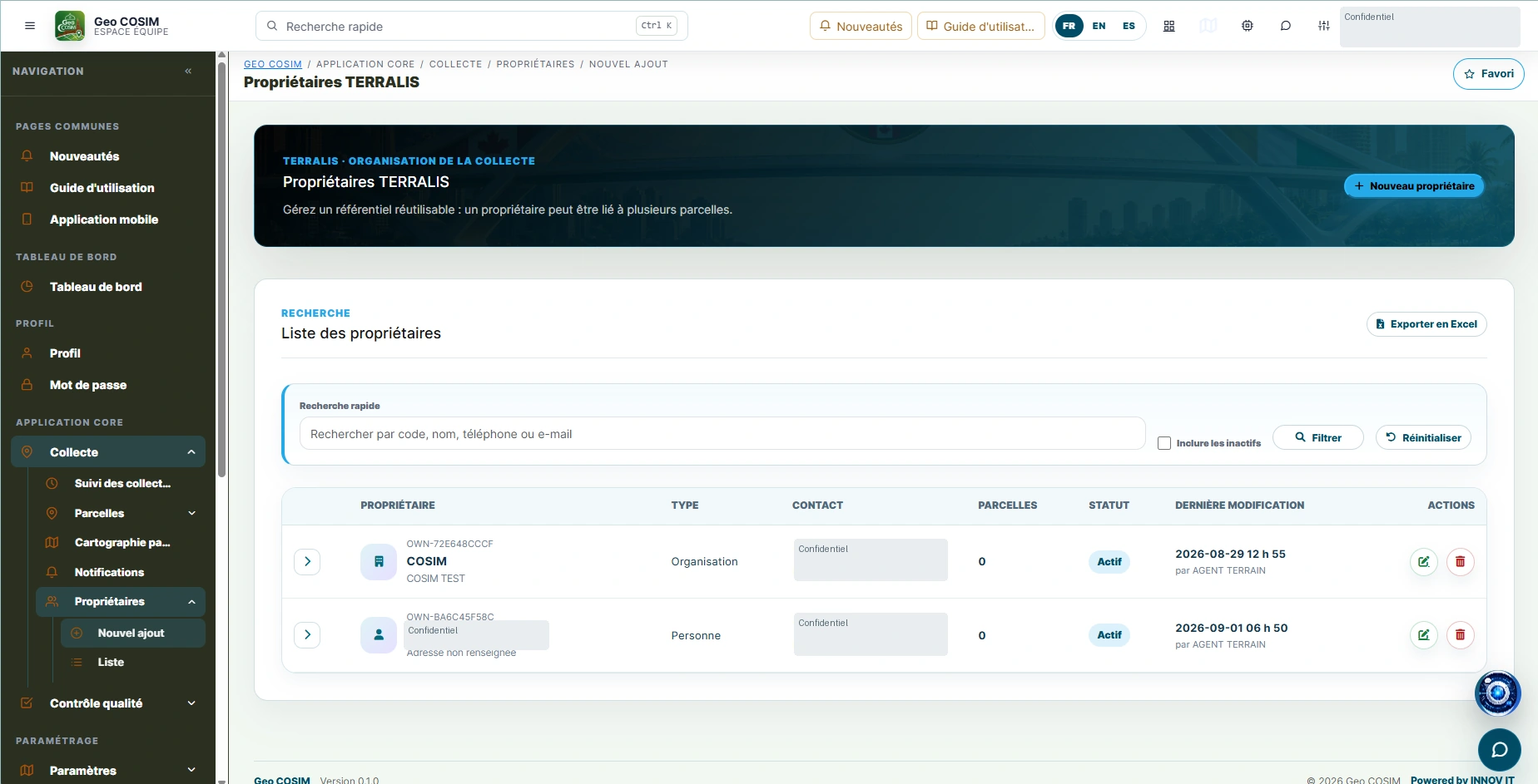
Owner management 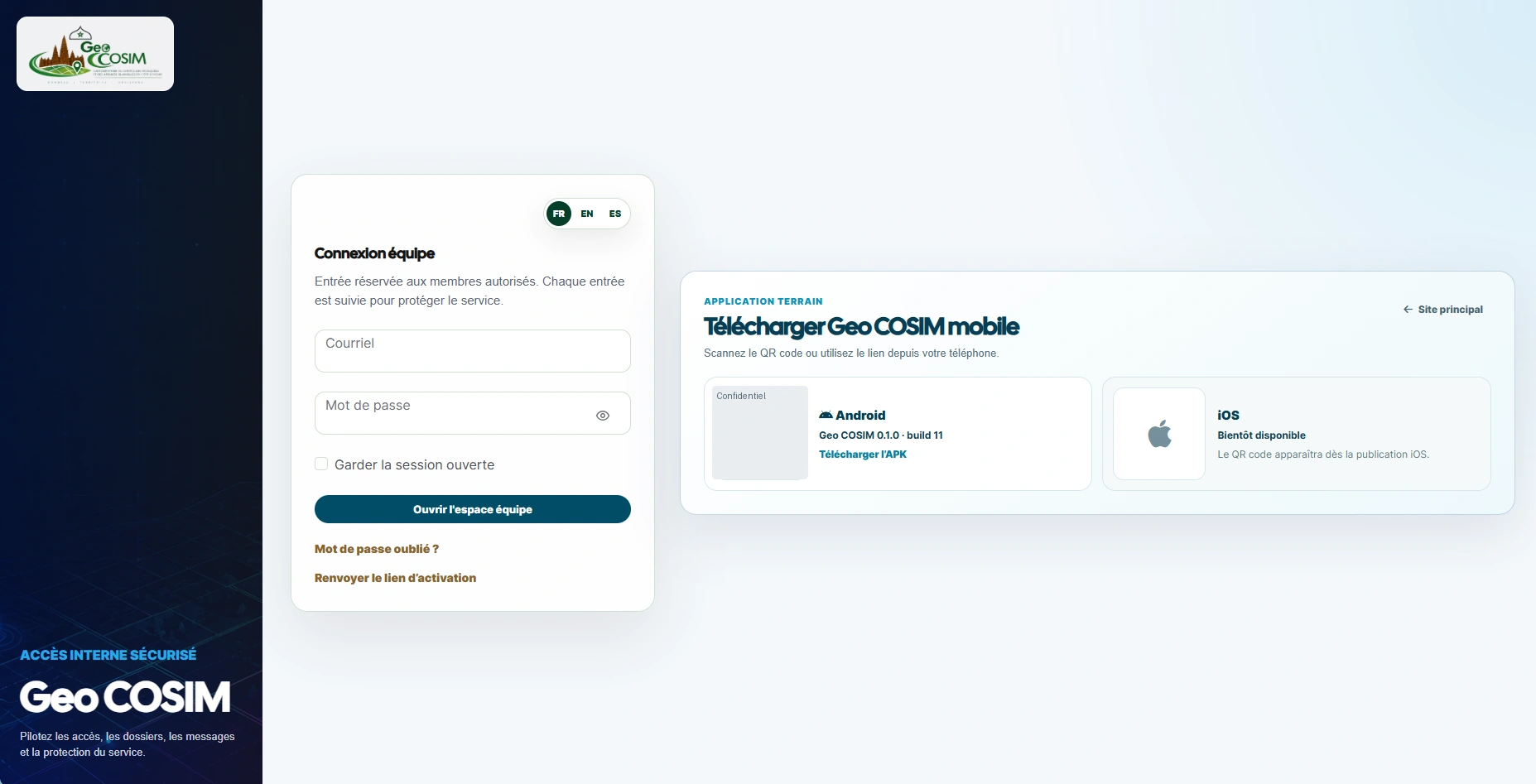
Team space & mobile access
Connect parcel collection, geographic exploration and quality review in a shared web and mobile environment.
The challenge
Field information needs to move coherently from collection to verification, with geographic records, supporting files and a traceable decision history.
Our engineering focus
- 01Parcel collection, mapping & WGS 84 geometry
- 02Searchable records, map layers & controlled exports
- 03Quality review, validation workflows & audit history
Project scope, delivery references and demonstrations are available on request, subject to confidentiality.
LET’S BUILD SOMETHING THAT MATTERS
Bring us your
next challenge.
A new platform. A complex integration. A better way to see your data. Let’s start with the problem you want to solve.