
Expertise / 01
Geospatial intelligence
See the bigger picture. Down to the local detail.
See the bigger picture. Down to the local detail.
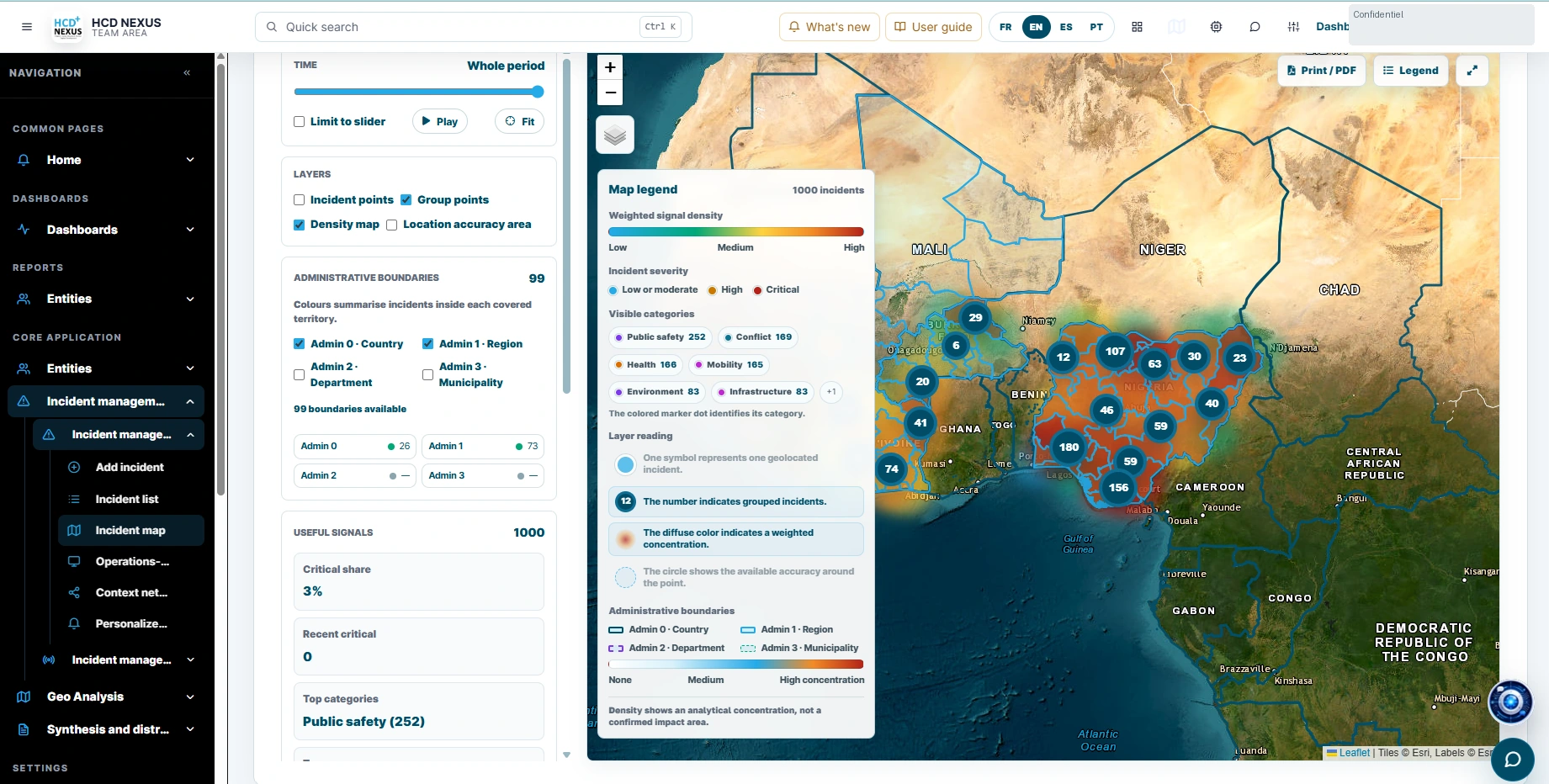
Bring geography into your decisions. We connect field observations, administrative boundaries and thematic layers in clear, useful spatial tools.
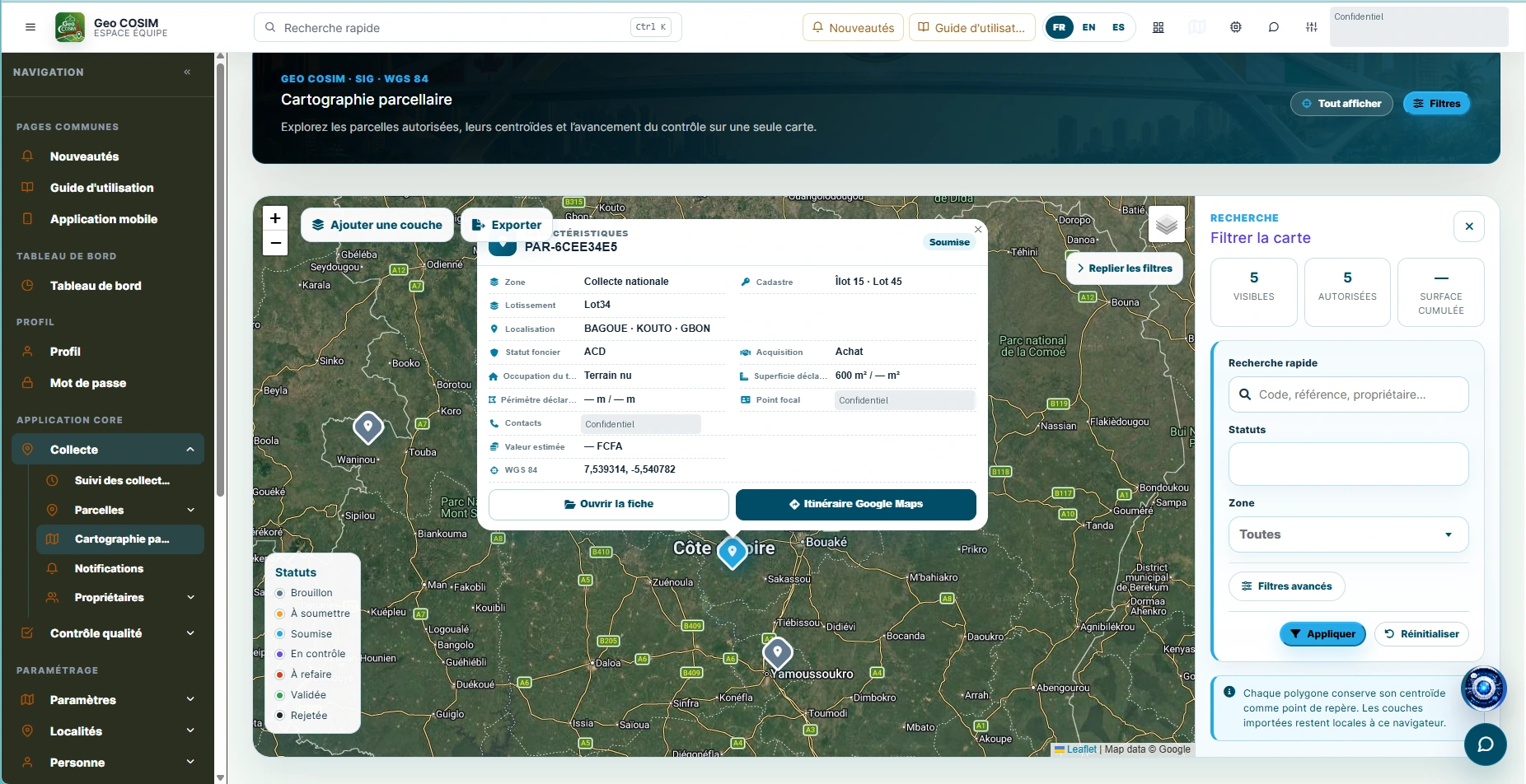
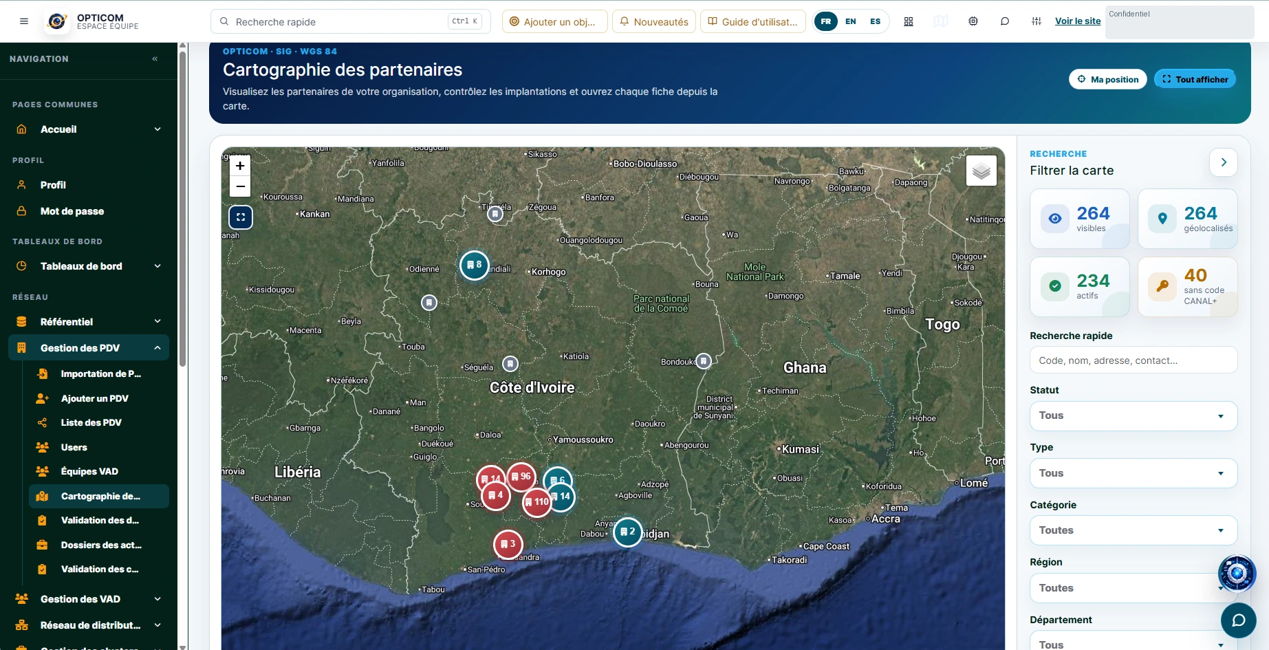
Whether you are following land parcels, public services or programme coverage, we help you compare territories and connect each location to its supporting records.
Discuss this capabilityWhat we build
- 01
Interactive maps & spatial analysis
Explore layers, filter by area and inspect the information behind each mapped feature.
- 02
Administrative hierarchies & subnational indicators
Organise countries, regions and districts consistently to compare indicators at the right level.
- 03
Field collection, geolocation & quality controls
Capture coordinates and supporting evidence, then review completeness and location accuracy before validation.
- 04
Raster, vector & open geospatial integration
Combine imagery, vector layers and open datasets with documented sources and compatible coordinate systems.
Where it makes a difference
Territorial planning, land information, programme monitoring and local risk analysis. For example, compare service coverage between districts or review a parcel alongside its field observations.
LET’S BUILD SOMETHING THAT MATTERS
Bring us your
next challenge.
A new platform. A complex integration. A better way to see your data. Let’s start with the problem you want to solve.